Mining surveying is an important part of engineering surveying, which covers making measurements in underground workings, open pits, but also under the water surface. However, these are also control measurements that allow you to check the geometry of mining facilities, structures, devices and machines in relation to the design assumptions and legal regulations. Thanks to mining surveyors, mining plants can conduct their activities, but can also implement other underground investments, such as communication and transport tunnels, collectors and underground structures. A mining surveyor is a geospatial manager, including not only mining excavations, but also the surface and objects built upon it, which may be affected by mining exploitation. The analysis of deformations of this area as well as the objects and the related environment is also subject to measurement assessment. A mining surveyor performs work with the use of the most modern measurement and computational techniques, which guarantee obtaining a precise answer about the safety of the mining entrepreneur's operations, as well as the environment, facilities and people affected by the investment. The topics proposed during the workshop are related to the following three basic activities of a mining surveyor: the staking out and control of the geometry of objects will be shown by presenting laser scanning techniques, environmental impact - by assessing the transformation of the state of the surface water environment in artificially drained mining and post-mining areas for the purpose of acquiring metadata for spatial development plans, and InSAR radar analysis of surface deformations. Specialized measuring devices will also be presented, allowing to perform tests in mining shafts and excavations in a way that is unique in the world.
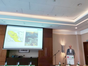
WELCOME AND OPENING REMARKS
Prof. Ryszard Hejmanowski (AGH UST)
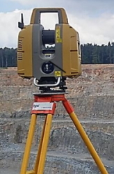
A. Adamek (Skala 3D Ltd.):
Mobile mining platform - Application in the precise
acquisition of 3D data in mining works
[abstract]
[handouts]
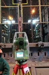
M. Sorkowski (LW Bogdanka S.A.):
The use of 3D laser scanning techniques in an
underground coal mine. The example of LW "Bogdanka" S.A.
[abstract]
[handouts]
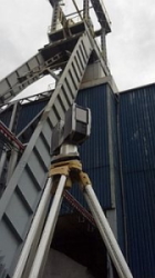
J. Kukuła, W. Kumosiński (KGHM PM S.A. O/ZG
Lubin):
Laser scanning technology as the modern way of data
acquisition based on selected jobs completed in KGHM Polska Miedź S.A.
[abstract]
[handouts]
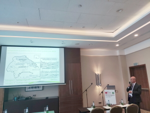
D. Ignacy (GIG Research Institute):
Comprehensive Method of Assessing the Flood Threat of
Artificially Drained Mine Subsidence Areas for Identification and
Sustainable Repair of Mining Damage to The Aquatic Environment
[abstract]
[handouts]
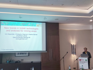
U. Wegmüller, C. Magnard, C. Werner, S. Leinss
(Gamma Remote Sensing AG):
New trends in InSAR technologies and analyses for mining
areas
[abstract]
[handouts]
W. Stolarski (Geotronics Ltd.):
Underground measurements of hard-to-reach spaces with a
special inspection system (drons)
[abstract]
[handouts]
19:00-22:00 Dinner
The presentations are to be followed by 15 minutes of discussion
The workshop is possible due to a collaboration between FIG Commission 6 (Engineering Surveys), the Faculty of Mining Surveying and Environmental Engineering of the AGH UST (Kraków), the Faculty of Mining, Safety Engineering and Industrial Automation of the Silesian University of Technology (Gliwice), the Department of Geology, Geophysics and Environmental Protection of Central Mining Institute (Katowice), and the International Society for Mine Surveying.
 |
 |
 |
 |
 |
 |
 |
 |
 |
 |
 |
| Pre-event Sponsor |
 |
|
 |
| Organizers |
 |
 |
|
|
| The International Society for Mine Surveying | The Faculty of Mining, Safety Engineering, and Industrial Automation of the Silesian University of Technology | Department of Geology, Geophysics and Environmental Protection of Central Mining Institute | Faculty of Mining Surveying and Environmental Engineering of the AGH University of Science and Technology |
 #FIG2022 |