From the start of the 2011-14 term FIG Commission 5 has
investigated practical solutions to global survey problems, and
facilitated technical activities pertaining to the development,
use and integration of technologies for positioning,
measurement, survey infrastructure, and the associated
standardisation, best practice and fundamental reference frame
issues.
Our specific activities have been aimed at developing
countries, low cost surveying technologies, implementation of
modern geodetic reference frames, applications of geospatial and
positioning infrastructure, and the professional development of
the operational surveyor.
Throughout the current period, Commission 5 has focused work
on achieving realistic tangible outcomes for our five missions,
which are -
FOCUS on modern technologies, technical developments and
applications
FACILITATE and follow technical developments through
collaborations with other FIG Commissions and like
organisations
FOSTER and support research and development and
stimulate new ideas in the fields of expertise represented
within the commission.
FORMULATE and formalise collaboration with manufacturers
on the improvement of instrumentation and associated
software.
FIG EVENTS - present and promote the work of the
Commission and its working groups through technical events
and necessary media
During the period, the Commission 5 has focused our energy to
ensure that the annual FIG Working Weeks in Marrakech, Rome,
Abuja and Kuala Lumpur have been successful, as well as the FIG
Regional Conference in Montevideo (Uruguay) and the FIG Pacific
Small Islands Developing States Symposium in Suva (Fiji). To
date Commission 5 has facilitated over 275 technical
presentations at our technical sessions, special forums or
meetings.
We have also effectively collaborated with our sister
organisations at various events to promote and fulfil the
objectives of our work plan, especially at events such as the
General Assembly for the International Union of Geodesy and
Geophysics (Melbourne, Australia), the annual International
Committee on GNSS events (Tokyo (Japan), Beijing (China), Dubai,
(UAE)) and the symposium series on Mobile Mapping Technology.
In addition to this, the Commission has been responsible for
the Technical Seminar on Reference Frames in Practice, which
have been convened jointly with the with the International
Association of Geodesy (IAG), the United Nations Global
Geospatial Information Management – Asia Pacific (UN GGIM-AP),
the International Committee on GNSS (ICG) and our Platinum FIG
Corporate sponsors. We have held two technical seminars, one in
Rome (Italy), and the other in Manila (Philippines). These
seminars examined reference frames issues pertinent to each
region. Smaller versions of this technical seminar have also
been organised within the technical program of other FIG events.
The Commission has also recently prepared two publications
which are to be released at the FIG Congress in Kuala Lumpur.
The first is an updated version of FIG Publication No 49 - Cost
Effective GNSS Positioning Techniques, and the second is a new
publication consisting of technical fact sheets to form a
“Reference Frames in Practice Manual”.
Another key highlight for the Commission during the term so
far was the development of a special edition for the Journal of
Applied Geodesy which was undertaken with IAG and includes
papers on Ubiquitous Positioning and Navigation Systems.
The ongoing success of FIG Commission 5 is largely due to the
dedicated hard work of our Working Group Chairs and members from
Commission 5. They have all been actively representing FIG at
numerous related symposia around the world and whilst advancing
the work of the working groups.
Work plan
Terms of reference
The science of measurement (instrumentation, methodology and guidelines)
The acquisition of accurate and reliable survey data related to the
position, size and shape of natural and artificial features of the earth and
its environment and including variation with time.
Mission statement
The mission of Commission 5 is to:
focus on modern technologies, technical developments and assist
surveyors, engineers and GIS/LIS professionals through guidelines and
recommendations, to choose and utilise those methods, technologies and
instruments that are most appropriate to different applications.
facilitate and follow technical developments through collaboration with
other FIG Commissions and other international organisations; participation
in appropriate meetings; and the preparation of appropriate publications.
foster and support research and development and stimulate new ideas in
the fields of expertise represented within the commission.
formulate and formalise collaboration with manufacturers on the
improvement of instrumentation and associated software.
FIG Events - present and promote the work of the Commission and its
working groups on an on-going basis at FIG Working Weeks, FIG Regional
Conferences and other relevant technical meetings and in appropriate FIG and
other media.
Working Group 5.1 - Standards, Quality Assurance and Calibration
Policy Issues
Influence the development of standards affecting positioning and
measurement instruments and methods, in collaboration with the FIG Standards
Network and through participation in the relevant technical committees (TCs)
of the International Standards Organisation (ISO) and other appropriate
bodies.
Acceptance controls, quality assurance and certification and their
impact on the surveying profession.
Testing and calibration of measuring instruments.
Assist other Commission Working Groups to implement Standards from TC
172/SC 6 and ISO TC211 as appropriate
Chair
David Martin
FRANCE
E-mail: martin[at]esrf.fr
Working Group 5.2 - Reference Frames
Policy issues
Work to bring together all organisations involved in defining or
using reference frames to develop common approaches and avoid
duplication. Such organisations include FIG, the International
Association of Geodesy (IAG), ISO, groups of national mapping agencies,
other influential national agencies (such as the US Department of
Defence’s National Geospatial-Intelligence Agency (NGA), which is
responsible for WGS84.) and alliances of commercial organisations (such
as Open GIS Consortium and the European Petroleum Survey Group).
Continue the existing co-operation with IAG on the Regional
Reference Frame Projects such as AFREF, APREF, EUREF, NAREF, and SIRGAS.
Consider options for the development and implementation of
4-dimensional datums that incorporate the effects plate tectonic and
regional effects such as those due to earthquakes or local effects such
as landslides.
Provide background technical information on relevant issues written
in a way that is accessible to the surveying practitioners.
Develop an inventory of approaches to reference frame issues in
different countries (including transformation methodologies) that is
accessible to surveying practitioners.
Examine how surveying practitioners can access the reference frame,
through less emphasis on networks of ground monuments and more emphasis
on Global Navigation Satellite Systems (GNSS) base stations.
Provide information on the maintenance of CORS networks to ensure
long-term stability
Liaise with Commission 4 to review, revise and update FIG
Publication 37, Vertical Reference Surface for Hydrography
Chair
Graeme Blick
NEW ZEALAND
E-mail: gblick[at]linz.govt.nz
Working Group 5.3 - Geodetic and Positioning Infrastructure
Policy issues
Examine the positioning services using CORS.
Examine various positioning techniques using GNSS
Examine existing automated positioning software via WWW
Real time networks
GNSS products and advancements
Provide FIG input during planning and implementation phases
associated with programs of GPS Modernisation and GNSS Development.
Chair
Neil D. Weston
USA
E-mail: Neil.D.Weston[at]noaa.gov
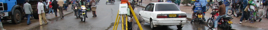
Most surveyors can operate and manage their instruments if no movements
occur. But what happens, if the instrument or the surveyed object is moving? New
problems arise like e.g. synchronisation of the measurements and modeling of the
movement. These and other related tasks, investigations and practical solutions
are summarized under the term “kinematic measurements”. Multi-sensor-systems and
their application play an important part for kinematics.
If you are interested in this topic related to monitoring as well as machine
guidance, then you should definitely join this group to share your experience or
learn from others. We will organize sessions at FIG events, participate at
symposia on related topics e.g. “Machine Guidance and Control” and “Mobile
Mapping” and facilitate the interchange of knowledge among practitioners and
researchers.
Policy issues
Cooperation with all organisation involved in the field of GNSS e.g. IAG
and ISO
Bring to together practitioners, instrument manufactures and scientists
that deal with kinematic measurements
Maintaining contact with instrument and sensor manufactures to provide
state-of-the-art information to the users
Co-operation with Commission 6 WG “Machine Guidance and Control”
Co-operation with study groups IC-SG2 and IC-SG3 of the Intercommission
Committee on Theory (ICCT) of the International Association of Geodesy
Working Group 5.5 – Ubiquitous Positioning
(Joint Working Group with Commission 6)
This group, which is a joint working group between FIG and IAG, will
focus on the development of shared resources that extend our understanding
of the theory, tools and technologies applicable to the development of
ubiquitous positioning systems. It has a major focus on;
Performance characterization of positioning sensors and technologies
that can play a role in the development of ubiquitous positioning
systems
Theoretical and practical evaluation of current algorithms for
measurement integration within ubiquitous positioning systems.
The development of new measurement integration algorithms based
around innovative modeling techniques in other research domains such as
machine learning and genetic algorithms, spatial cognition etc.
Establishing links between the outcomes of this WG and other IAG and
FIG WGs (across the whole period)
Generating formal parameters that describe the performance of
current and emerging positioning technologies that can inform FIG and
IAG members.