Need for International Ethics Standards, Peace and Gender EqualityFIG Commission 1: Professional Standards and Practise"Commission 1 focuses on establishing a set of ethical principles that fits the surveying profession for reference by professional institutions. It also focuses on promoting greater understanding and improving community perceptions about the surveying profession, which is underlined by the foundation’s vision to improve gender equality and maintaining global peace and justice, in line with Goal No. 5 and 16 of the United Nations Sustainable Development Goals (UNSDG) respectively."Highlighting the sessions of FIG Commission 1Commission 1 received a well coverage of technical papers for the topics related to Professional Practice, Boundaries and Women in Surveying. All the submissions are related to the theme of Smart Surveyors for FIG Working Week 2020. Apart from the papers, there is an open meeting about International Ethical Standards (IES), in which FIG members and participants can present and discuss examples of high standard practices. Once these examples are identified and discussed, the FIG Council will assess whether the current FIG Ethics Code should be updated or adapted to the IES-Code. This can finally lead to a discussion about a harmonisation or replacement of the existing Ethical Code of FIG. TS05D: Professional PracticeThis session will discuss if the professional pathway will be market-relevant, how the land surveying profession can meet the demand of surveying services in the 21st century and at the same time to maintain the required professional standards and practice. With the rapid land and property development and construction of mega infrastructures, the reliance on and demand for versatile and reliable surveying services have become the new norm. Simultaneously, surveying technology is making a quantum leap that elevates the finished products to greater heights and to meet the ever-advancing standards, and the fulfilment of the 17 UNSDGs for 2030, at least eight of which are directly land-related or have land implications. As smart surveyors, we should harness modern-day technology in the provision of our services to the global community, thus enabling smart city development. In addition, China’s One Belt One Road Initiative, which reaches out to 60+ countries and regions and as far as Europe, poses a pressing need for consistent common standards, practices and ethical standards for professional surveyors to comply with when undertaking surveying works, wherever they are. The International Ethics Standard Coalition (IESC) has published ten principles as follows:
These principles are for members to consider for incorporating in their own standards and are applicable to all sectors of surveying services as practised by FIG members.
Ethical conduct and competence involve all sectors of the surveying profession, no matter where the surveyors are practising. If they are seen not to be performing up to the agreed standards even in one aspect, that may tarnish the reputation of the surveyor himself/herself or even his/her company/organisation. Although it is the vision of international consultants/organisations, such as FIG, to have one common set of practising and ethical standards for surveyors to follow, more often than not, this has not been the case. Even if there is an existence of such standards which are valuable for that country/region, keeping these global standards up to date is as important as the establishment of these standards itself. This is to ensure that our profession continues to enjoy a highly reputable global presence. Having a set of universal ethical and practising standards are not easily achievable. As an interim measure, publicity should be made to FIG member organisations inviting them to refer to or to adopt the standards drawn up by IESC. At the same time, research is to be carried out on the various standards being practised amongst FIG member organisations, with a view to comparing and analysing these standards and hopefully drawing up a sample for reference or adaptation. In the long term, there should be a set of universal practising and ethical standards for all surveying activities around the world and for surveyors to be well equipped for venturing into the 21st Century. In the 21st Century, the surveying services market will be more competitive: more sophisticated equipment and advanced information technology systems will emerge, the expectation of clients will be raised, with even more care and attention placed on ethical standards than ever before. TS06D: Boundaries for PeaceThis session will discuss the importance of boundaries and borders to determine the ownership rights and to sharpen the profile of land surveyors as servants for the peaceful living together in the world and to achieve SDG16 Peace and Justice Strong Institutions. In the “Mending Wall” by Robert Frost, he says,
“Good fences make good neighbours”. Or in the
surveying context, it can be said as “Good
boundaries make good neighbours.” This is true for
neighbouring owners of plots of land and equally
true for two neighbouring states. As can be
seen from history, there had been or even are
ongoing conflicts between adjoining states because
of disputes over common boundaries or ownership of
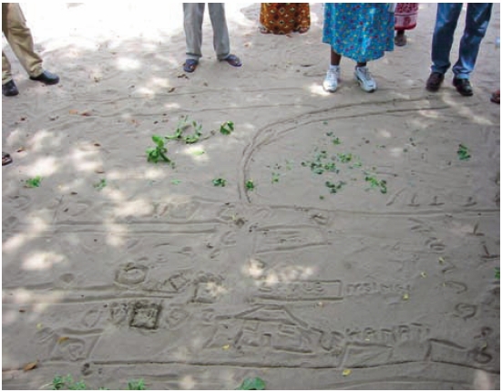
land due to various reasons. Sir Charles Brickdale (1857-1814), a British barrister with considerable land administration experience, is renowned for the following definition of land: “Land is the place of all shelter, in the city, the town, the village and the home. It is the source of food, of materials for construction and manufacture, of coal, gas and oil, of springs and rivers and other essentials for life. Indestructible, immovable, it is the foundation of all human activity and the ultimate source of wealth.” Therefore, it is understandable that some states are endeavouring to protect their land, while some are seen to be too aggressive thereby creating disputes, even willing to use military confrontation. The disputes over international boundaries have increased substantially since the World War II because of the rising number of new sovereign states and the absence of old boundary marks or evidence established previously for various purposes and the lack of trust or incentive to settle the common boundary in-between states, whilst it is fully realised that unclear or disputable boundaries would lead to unrest or even wars between states concerned. Substantial international efforts have been invested under the influence of the United Nations to settle international boundary disputes for the maintaining global peace and stability. FIG has carried out a study on the boundary delimitation in some ten states in the Middle East and Africa, which had been involved in boundary-making with various degrees of progress. The Study Report was published in 2013, which contains rich information, knowledge and practices for the delimitation of international boundaries. The delimitation of the Israel and Jordon boundary is a good and successful example, which has sustained 25 years of peaceful occupation after signing the Peace Treaty. |
|||||
|
The Peace Treaty between Israel and Jordan included an international boundary delimitation between the two states. For this exercise, each side had set up a Joint Boundary Committee to look after political and policy issues and a Joint Team of Experts to look after technical issues. All problems must be resolved between the relevant teams before proceeding further to the next stage of work. The international boundary had a total length of 400 kilometres and was demarcated by 124 boundary pillars, with each state needing to erect 62 pillars. As an innovative idea orthophoto maps were used for the first time for the delimitation, i.e. from indoor planning, site reconnaissance, provisional placement of pillars, recording of the placed pillars and documentation for annex to the Peace Treaty. |
|||||
|
The boundary lines ran on land, in the sea, through lakes, and along rivers. The various boundary-making procedures included demarcation, monument placement and surveying, boundary documentation and maintenance. Helicopters were used for accessing difficult terrain and high precision GNSS to centimetre level was used for position fixing. The whole field operation was executed under close monitoring by the Joint Team of Experts one from each side and was completed in three months before 26/10/1994. It can be seen that international boundary delimitation is a highly sophisticated and technically demanding exercise, requiring the most advanced technology in surveying and geospatial information systems, experienced boundary delimitation experts, as well as support from national surveying and organisations from both sides to carry out the field surveys and production of maps. Above all, for a boundary delimitation initiative to be successful, it must have the blessing of the governments of both sides. Both sides share a determination and commitment to establish a clear and definite boundary, not to bar people from passing through but to allow a free and safe thoroughfare thereby promoting peace and prosperity for the two states concerned. This task also requires the mutual understanding, respect and trust from each other, and the firm belief that this meaningful project is for the well-being of their people, and generations to come, and bring peace to this world. TS04D: Women in Surveying for Gender EqualityThis session will discuss the opportunities of women in surveying of today and tomorrow. FIG delegates will discuss what proactive steps they have taken to promote women in surveying and the World Bank’s initiative about stand for women’s land campaign.
Under FIG definition, a surveyor is a professional person with the academic qualification and technical expertise to practice the science of measurement; to assemble and assess land and geographic related information; to use that information for the planning and implementing the efficient administration of the land, the sea and structures thereon; and to instigate the advancement and development of such practices. The work of surveyors from different sectors of surveying revolves around the land and its development, such as: survey the size and shape of the earth and the position of any physical features on, above and below the ground; the determination of public and private land and international boundaries; the management of geographic information system; the planning development and redevelopment of property; the assessment of value and the management of the property; the management of construction works, and the production of maps and charts. One’s gender should not be a barrier to performing these tasks. In the old days, land surveying, in particular, has been characterised by arduous work and a physically challenging outdoor working environment. Therefore, land surveying has not been a preferred source of employment for potential female surveyors, thereby deterring female students from taking up land surveying courses. However, with the advancement of surveying technology, a lot of field surveying jobs can be offloaded to automated and digital equipment, such as aerial imagery equipment, i.e. drones and laser scanners, and the data collected can be processed efficiently using applications interface. Therefore, in the surveying industry, there are a wider variety of jobs and positions to choose from. Moreover, whether these job seekers will take surveying as a career will depend on job satisfaction and advancement opportunities, which employers should offer. According to the 2017 statistics, in the EU, amongst the 18 million scientists and engineers, 59% are men and 41% women, and in the northern European countries, less than one-third of scientists and engineers are women. The issue of gender imbalance is also present in the surveying profession. Some call this a “leaking pipe”, and the possible reasons can be the presence of gender stereotypes, especially ‘traditional’ gender roles and the perceived inability for women to maintain a balance between work and family life. Therefore, a positive and long-term solution is needed to address this complex range of issues against the women in employment. In some developing countries, the surveying profession is regarded as a man’s profession and is mainly dominated by men. Even after graduation, women cannot find a surveying job. A sub-group called Women-In-Surveying under a professional institution was established in 2004 with the objectives of working for the welfare and interests of its members; to maintain high professional ethics among members; speak with one voice on issues affecting them, and to advocate for education for young girls, with a view to encouraging and supporting them to deliberately chose surveying as a course to study in the tertiary institution. Their aim is to propagate the ‘gospel’ of surveying by ensuring that the surveying profession becomes a choice career amongst the young girls. In the beginning, women membership was about 3% of that of the institution and rose to 10% very soon. The institution opined that women’s multiple roles as a career woman, professional, wife and home manager could not distract them from delivering optimum and satisfactory services at their various places of work as public servants or private practitioners. The institution supported the establishment of the Women-In-Surveying and cooperated harmoniously for the advancement of surveying in their country. Although gender stereotypes have a strong presence in the workforce, particularly in less developed countries, women surveyors around the world are courageous in forging their own paths and to eradicate the male-dominance tradition by bringing up more women surveyors in due course. Land had been defined as, ‘Indestructible, immovable, it is the foundation of all human activity and the ultimate source of wealth’. Consequent to the continuous and massive developments related to land to meet the growing needs of the community, it can be anticipated that the demand for greater numbers of professional surveyors from all sectors of surveying will emerge. ConclusionCommission 1 comprises three Working Groups:
International Ethics Standards, International
Boundary Settlement and Demarcation and Women in
Surveying. The Commission will continue carrying out
its work as published in the
Work Plan 2019-2022. We will maintain close
liaison with the International Ethics Standards
Coalition and those professionals who have
implemented International Ethics Standards and the
United Nations on peace and gender equality.
|
|||||
|
|||||
Further readings:FIG Working
Week 2020 Proceedings FIG Commission 1 Sessions:
FIG Commission 1 website: |
|||||
 #FIG2020 /font> |