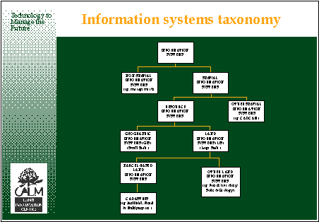
My short talk will deal briefly with some spatial information concepts as they relate to the cadastre from the Australian perspective. Initially we should consider the taxonomy or framework in which the spatial information data bases fit (diagram 1).
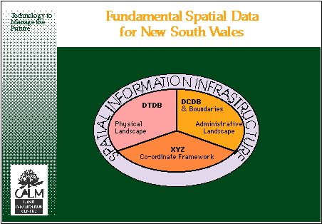
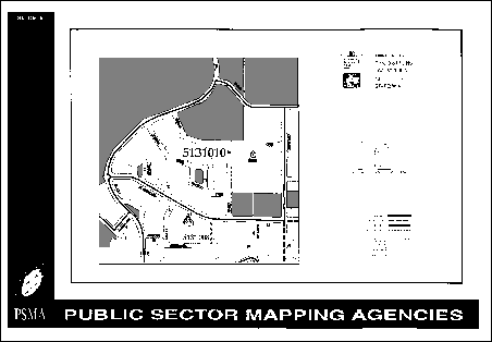
The spatial information trinity of the coordinate system, the administrative landscape and the physical landscape make up the spatial information infrastructure. In Australia the mathematical basis which provides the spatial rigour is in place and spans from the geodetic network to the survey control network which in turn is connected by direct survey means to the legal cadastral parcels. The administrative landscape is now manifested by the digital cadastral data base (DCDB) and the administrative local, state and national boundaries which overlay that digital data foundation. Indeed it (DCDB) is the reflection of mans imprint on the landscape. The physical landscape is now the digital product which was previously known as the topographic data base (DTDB) (diagram 2).
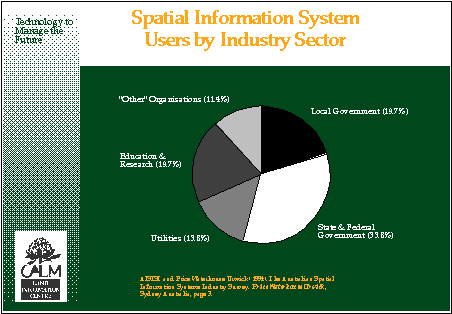
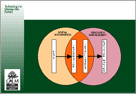
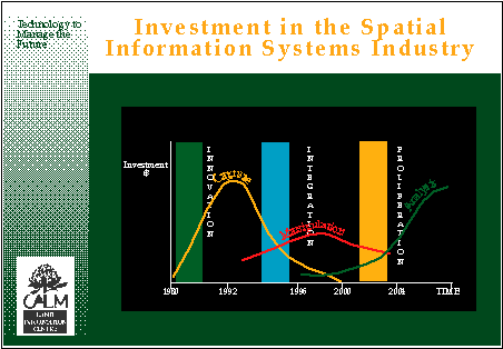
It is relevant to identify the users for whom the spatial information data bases serve a purpose (diagram 3). As the creature now known as a spatial information broker grows in stature, knowledge and in number the users profile will change; the legal or land registration application of the spatial component or survey system will diminish relative to the escalating use of the spatial information by the marketplace as the socio-economic applications increase. We should also question the path through which spatial information must pass - from data, to information, to intelligence, leading finally to a means of achieving sound and rational decision making. It would seem we are currently somewhere between information and intelligence on my model (diagram 4). The reason for this is the shortage of spatial data and the fact that emphasis has been on the acquisition phase up to date. When we were through the manipulation phase and reach the analytical phase in five to ten years time we will be capable of sound decision making (diagram 5).
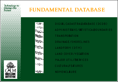
I should mention that I believe it is the spatial information infrastructure comprising of the attributes on diagram 6 which should remain in the ownership of the state whilst the many other themes or subsidiary bases should be managed and even owned by the private sector. The fundamental data bases are the "crown jewels" of the spatial information industry and should be the responsibility of the state to maintain, update and upgrade. The actual processes could of course be contracted to the private sector.
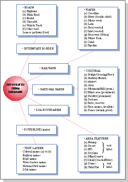
Finally I would like to deal with a cadastral innovation and that is the census mapping for Australia which will be completed in October of this year. It is a national initiative generated through a lead agency which receives data from all Australian State and Territory jurisdictions. This data is then integrated and the result is provided to the Commonwealth Bureau of Statistics for the conduct of the Census in 1996 (diagram 7). The attributes which make up this census data base are listed on diagram 8. The result of this work will be over 33,000 Census Collector Districts, each being the smallest spatial component to which socio-economic data can be linked for national planning purposes (diagram 9).
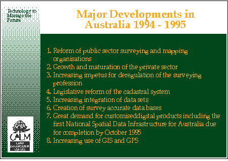
Finally I would like to describe what I see as the current major developments in Australia (diagram 10).
Speaker: Don M. Grant Tel. +61-63-328 204
Land Information Centre Fax
+61-63-322 320
Panorama Avenue
Bathurst NSW 2795
AUSTRALIA
Maintainer : David Mercer - webmaster@fig7.org.uk Last Modified: September 1996.