Article of the Month -
November 2022
|
Mapping and suitability analysis of
existing electoral polling units in Katsina local government area of
Katsina State, Nigeria
Adamu BALA (Nigeria), Saied
PIRASTEH (China, PR), Yahaya Abbas ALIYU, AbdulAzeez ALIYU, Swafiyudeen
BAWA and Ibrahim ABDULWAHAB (Nigeria)
This article was awarded the Survey Review Prize and
was presented during the FIG Congress 2022 in Warsaw.
FIG and Survey Review have
decided to award a paper presented at a
FIG Congress/Working Week. The Survey Review prize will be awarded
every two years to the author and presenter of a selected paper at a
FIG Congress/Working Week and will be limited to submissions from
authors who fulfil the FIG definition of a Young Surveyor.
Survey Review is an international journal which has been published
since 1931, and in recent years under the auspices of the Commonwealth
Association of Surveying and Land Economy (CASLE). It has been published
continuously as a quarterly journal, bringing together a wide range of
papers on research, theory, practice and management in land and
engineering surveying.
The paper selected for the prize passes through an initial reviewing
and revision stage overseen by FIG, before being judged by members of
the Editorial Board of Survey Review.
This year’s winner, “Mapping and suitability analysis of existing
electoral polling units in Katsina local government area of Katsina
State, Nigeria” by Adamu Bala, Saied Pirasteh, Yahaya Abbas Aliyu, Abdul
Azeez Onotu Aliyu, Swafiyudeen Bawa & Ibrahim Abdulwahab. Adamu
Bala
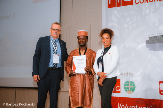
FIG Vice-President Diane Dumashie handing out the Surrvey Review Award
to Adamu Bala at the General Assembly held in Warsaw on 15 September
2022, together with FIG President, Rudolf Staiger.
SUMMARY
This research examined the mapping and analyses of existing
polling units in the study area to provide scientific
criteria for citing new polling units. The attribute data of
the polling units were collected from the Independent
National Electoral Commission (INEC), Katsina State, and
spatial data was acquired through field observation, for
geodatabase creation and query generation. For the
suitability mapping, seven parameters criteria were adopted.
The generated thematic maps of these criteria were
standardised using the fuzzy logic approach. The geodatabase
of the existing polling units created showed 281 polling
units with their attributes. Also, the suitability map
showed regions of suitability and unsuitability. The overlay
map showed that 10 polling units were in the region of
highly not suitable, 16 not suitable, 26 fairly suitable,
then the rest were either highly suitable or suitable. It is
recommended that INEC should adopt a scientific method in
citing subsequent polling units.
The full paper is available to read
here.


